Descripción
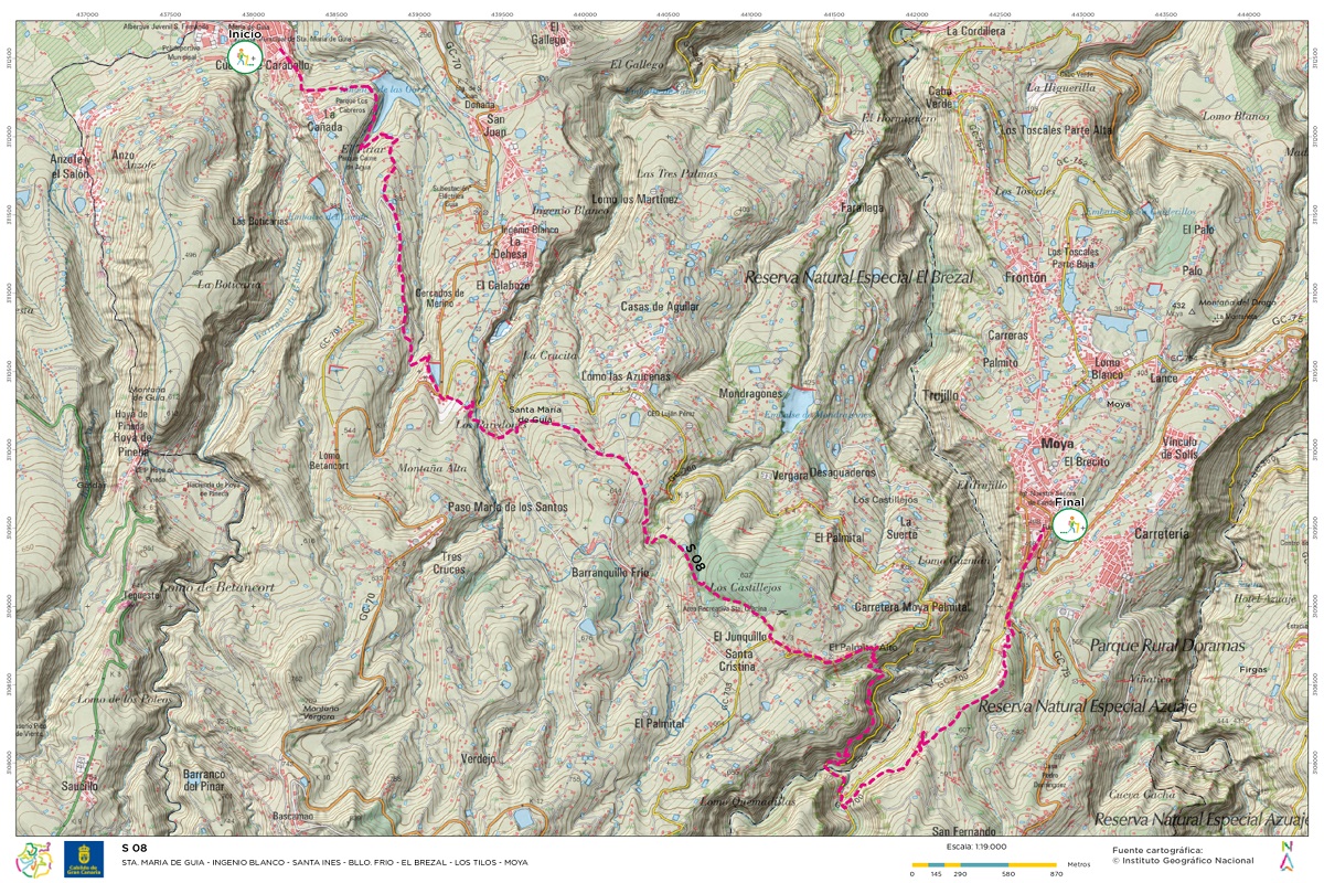
This is a long path with a moderate accumulated gradient, and is considered a path of high difficulty. The slopes it crosses do not have steep generalised gradients and are therefore relatively easy to overcome. However, there are short but demanding paved sections.
When crossing the Barranquillo del Ciruelo ravine and the tail end of the Presa del Regante dam, thick vegetation and watercourses can be found after rainy periods.
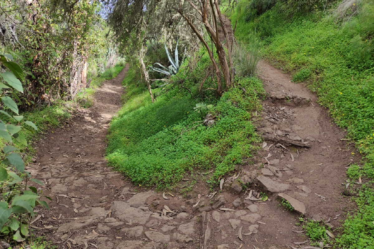
It is a fairly anthropic path, as it runs between farms for a large part of its route, connected by tracks, pavement and road, although just over half of its route is on well-surfaced paths. There is the possibility of leaving and sectioning the path, given the proximity to roads in the municipalities of Firgas and Santa María de Guía through which it passes, with public transport stops.
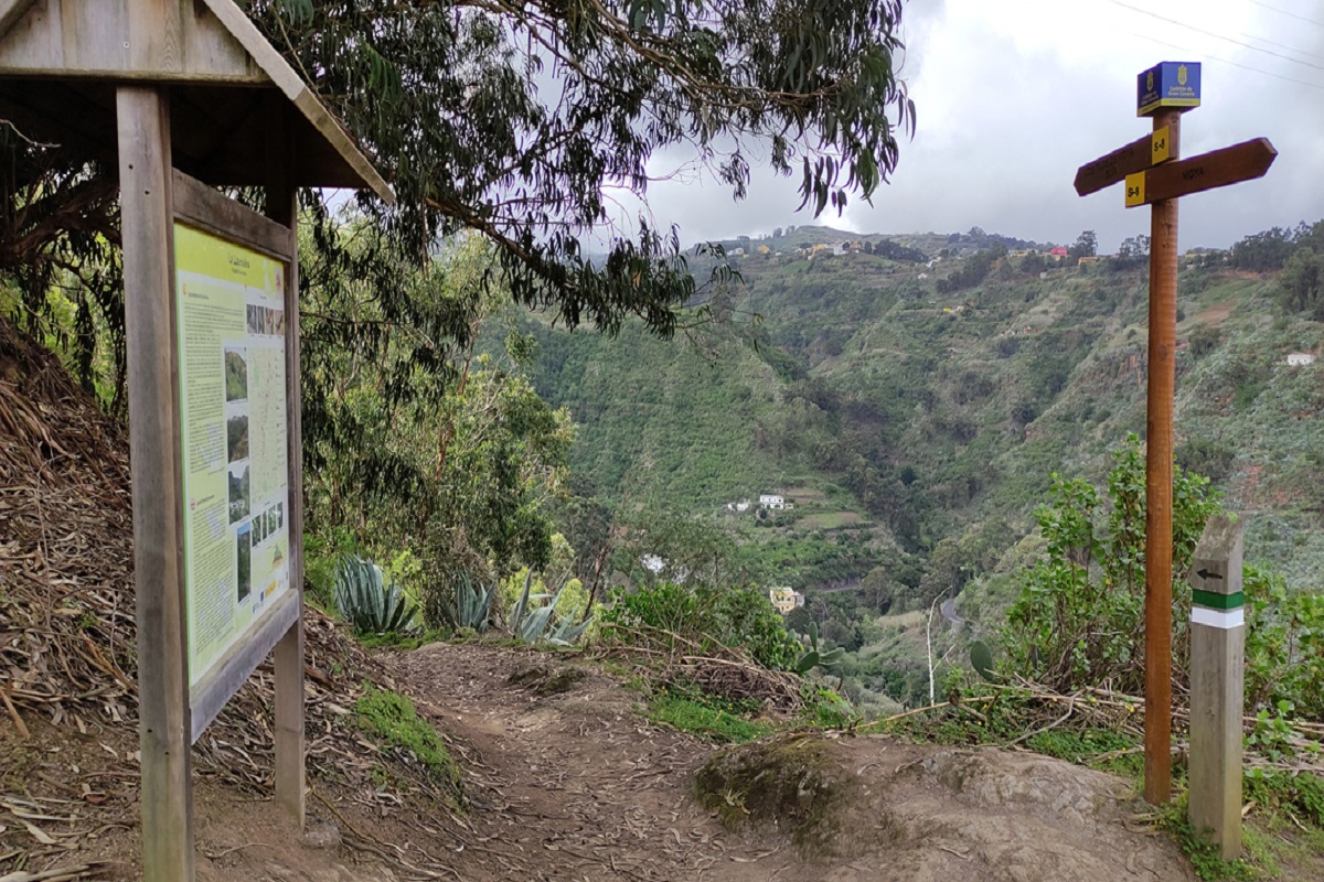
It links up with the SL 01Moy path, ideal for walking through the laurel forest of the Barranco de Moya ravine. On reaching the recreational area of El Brezal Santa Cristina it links up with the SL 2Guía trail, where you will find a bar and a place to relax.
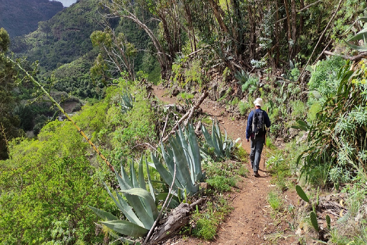
The beginning of the trail runs through the Doramas Rural Park (C-12), and then runs parallel to the perimeter of the El Brezal Special Nature Reserve (C-03). Along the route, you will come across hawthorn and granadillo bushes, as well as cardonales. It crosses areas close to the laurel forest (in the Barranco de Moya ravine), and there are also eucalyptus, pines, heather and fayas in the surroundings of the El Brezal recreational area, with a large part of the path being unprotected from the sun by trees.
When crossing the Barranquillo del Ciruelo ravine and the tail end of the Presa del Regante dam, thick vegetation and watercourses can be found after rainy periods.
It is a fairly anthropic path, as it runs between farms for a large part of its route, connected by tracks, pavement and road, although just over half of its route is on well-surfaced paths. There is the possibility of leaving and sectioning the path, given the proximity to roads in the municipalities of Firgas and Santa María de Guía through which it passes, with public transport stops.
It links up with the SL 01Moy path, ideal for walking through the laurel forest of the Barranco de Moya ravine. On reaching the recreational area of El Brezal Santa Cristina it links up with the SL 2Guía trail, where you will find a bar and a place to relax.
The beginning of the trail runs through the Doramas Rural Park (C-12), and then runs parallel to the perimeter of the El Brezal Special Nature Reserve (C-03). Along the route, you will come across hawthorn and granadillo bushes, as well as cardonales. It crosses areas close to the laurel forest (in the Barranco de Moya ravine), and there are also eucalyptus, pines, heather and fayas in the surroundings of the El Brezal recreational area, with a large part of the path being unprotected from the sun by trees.
Imagen principal
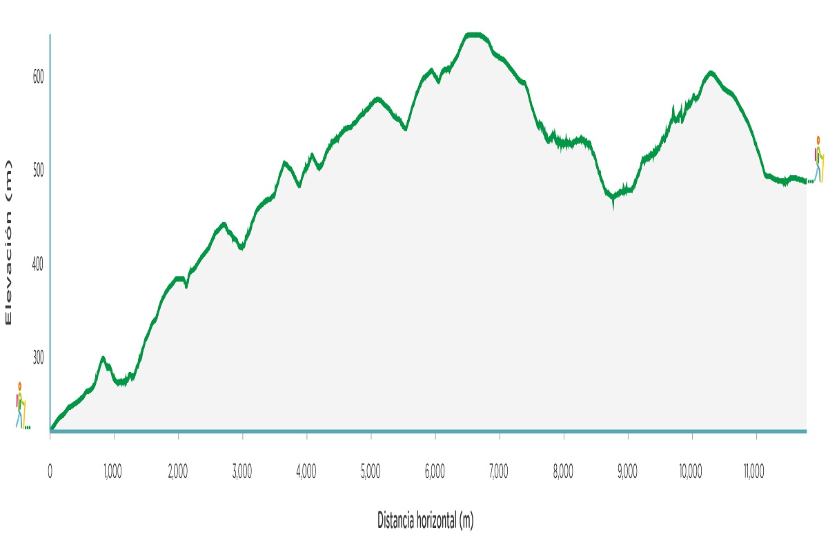
Distancia
12.00
Desnivel positivo
0.00
Desnivel negativo
0.00
Altitud máxima
642.00
Altitud mínima
217.00
Galería de imágenes
Archivo KML
S08.kml (34.16 KB)
Ubicacion donde empieza la ruta
28.137029706106, -15.629553794861
Horas de recorrido
4
Minutos de recorrido
14
Tipos de ruta
Tipos de circuito
Dificultad técnica